Climate - Teleconnections

El Nino Southern Oscillation (ENSO)
Composite Precipitation and Temperature Impacts
Latest ENSO Observations
Daily SST Anomaly
Weekly SST Anomaly
Monthly SST Anomaly 
Seasonal SST Anomaly 
Observed Regions
OLR Anomalies
850 mb Wind Anomalies
200 mb Wind Anomalies

Latest ENSO Forecasts
CPC CFSv2 Nino 3.4 

Arctic Oscillation (AO)
Composite Precipitation and Temperature Impacts
Observed/Forecast AO
Polar Vortex Cross Section

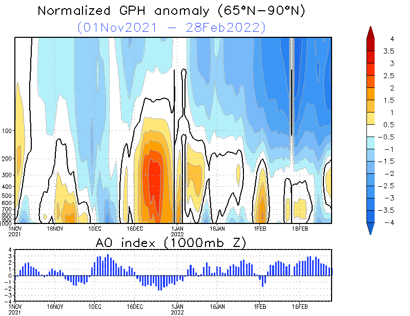
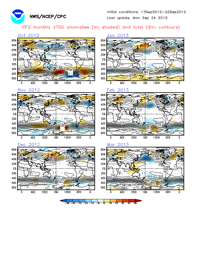
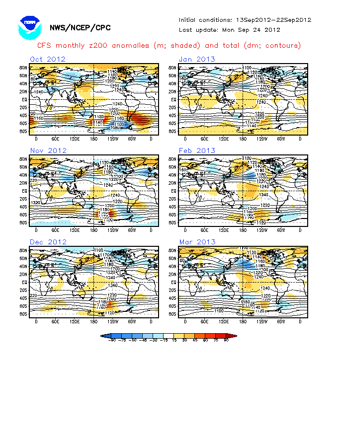
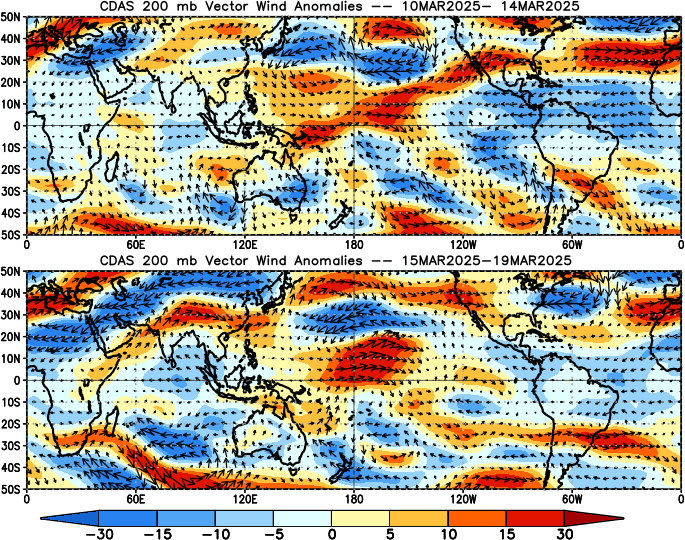
The Arctic Oscillation (AO) is compares 1000 mb height anomalies pole of 20N to those across the middle latitudes.

  • A positive AO suggests a stronger polar vortex with lower pressures near the pole, allowing the middle latitude jet stream to blow strongly and consistently from west to east, keeping colder air locked in the polar region.
  • A negative AO suggests higher pressures in the polar region, weaker zonal winds and the potential for acrtic air to move south into the middle latitudes. (1998 David WJ Thompson and John Michael Wallace)

North American Oscillation (NAO)
Obs. NH 500mb Anomalies
Observed/Forecast NAO
ERSl PSD Forecast
Forecast 700mb Anomalies
Affects on Weather

Pacific North American Oscillation (PNA)
Obs. NH 200mb Anomalies
Observed/Forecast PNA
ERSL PSD Forecast
Forecast 200mb Anomalies
Positive: Ridge (Warm) West and Trough (Cool) East. Negative: Trough (Cool) West and Ridge (Warm) East. Source

Madden-Julian Oscillation
MJO Temperature Impact Composites
MJO Precipitation Impact Composites
Phase 1 during Hurricane season can indicate active period.
Obs. Forecast Phase
OLR Anomalies
850 mb Anomalies
700 mb Anomalies
850 mb Time Lon Winds
200 mb Time Lon Winds
OLR Time Lon

Stratospheric Warming
Zonal Temperature Time Series
Current 1-hPa Analysis
Current 2-hPa Analysis
Current 5-hPa Analysis
Warming usually leads to a cold snap and stronger troughs. Time Series Analyses and Forecasts